
Railways in many parts of the world are built on embankments or adjacent to steep slopes. Climate change has brought increasingly frequent extreme weather events and slope failures have become more common, particularly following heavy rainfall. Failures can manifest in gradual settlement and disruption, or sudden landslips and significant threat to human life.
Historic management practice has been based on manual inspection and attended survey. More recent technological development has brought automated survey instruments, remote sensing and better data management, e.g., improved weather forecasting. All have limitations, however, such as limited spatial and temporal sampling, and the need for frequent site visits with associated costs and risks.
Robust and proven
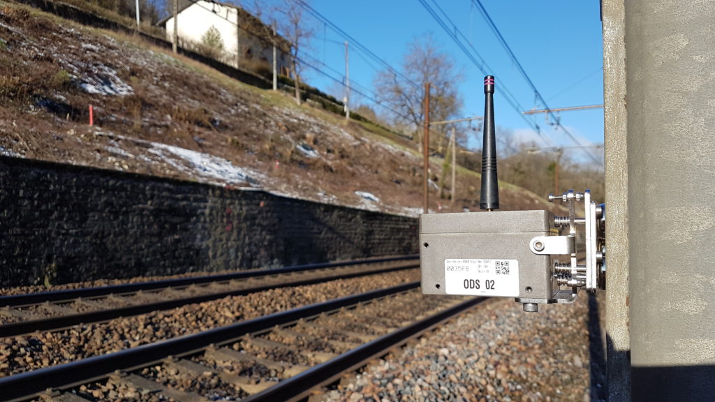
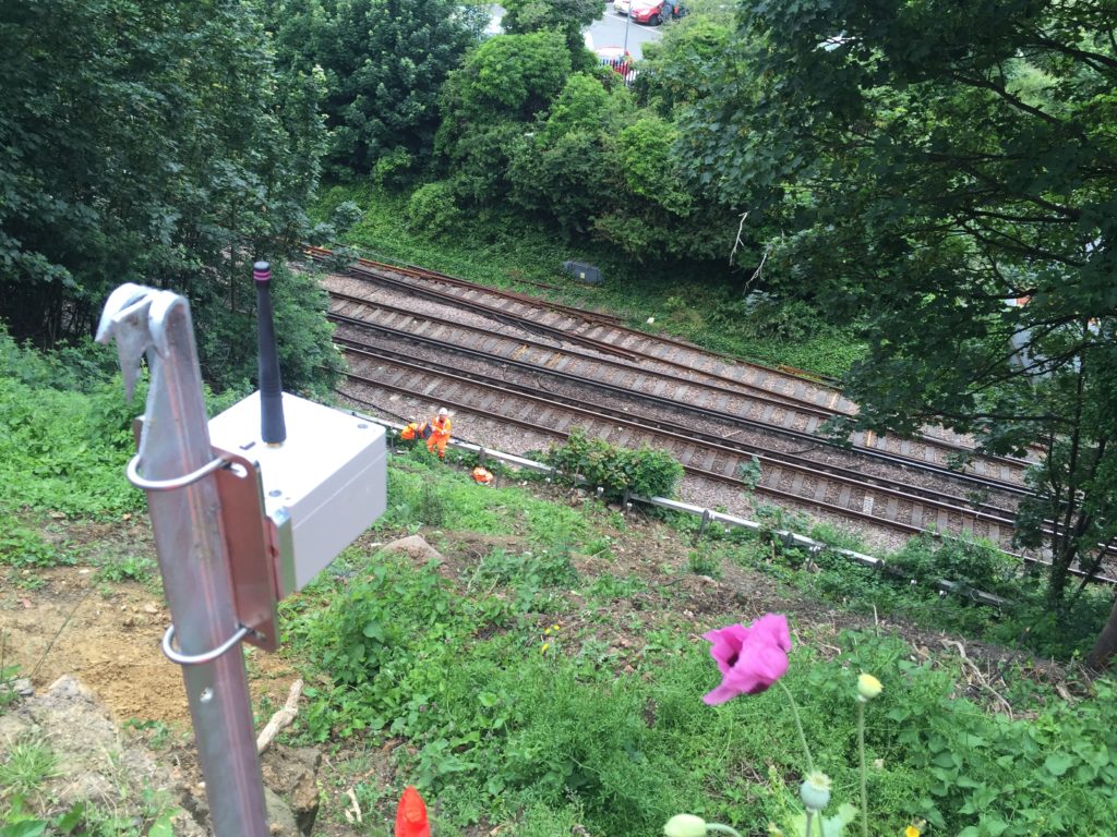
Remote condition monitoring specialist Senceive has pioneered the use of IoT technology over the last decade to provide a robust and proven wireless intelligent monitoring solution (IMS) to detect and respond to ground movement and provide early warning to geographically dispersed stakeholders. The core element of the system is a network of long-life movement sensors, connected to each other and the internet via a wireless radio platform.
The Senceive IMS displays many of the properties common to other IoT technologies: it is cost-effective; small; easy to install; and needs little or no maintenance over an ultra-long (10-15 year) life. It does not need mains power and has self-healing properties in the event of damage to individual components. It can integrate highly sensitive triaxial movement sensors with a wide range of other sensors including automated cameras, as well as geotechnical and structural logging instruments.
Over the last decade this technology has moved from the laboratory to become widely adopted by users such as Network Rail and HS2 who, together, have installed more than 10,000 of these smart sensors in the last year.
Considerable challenges
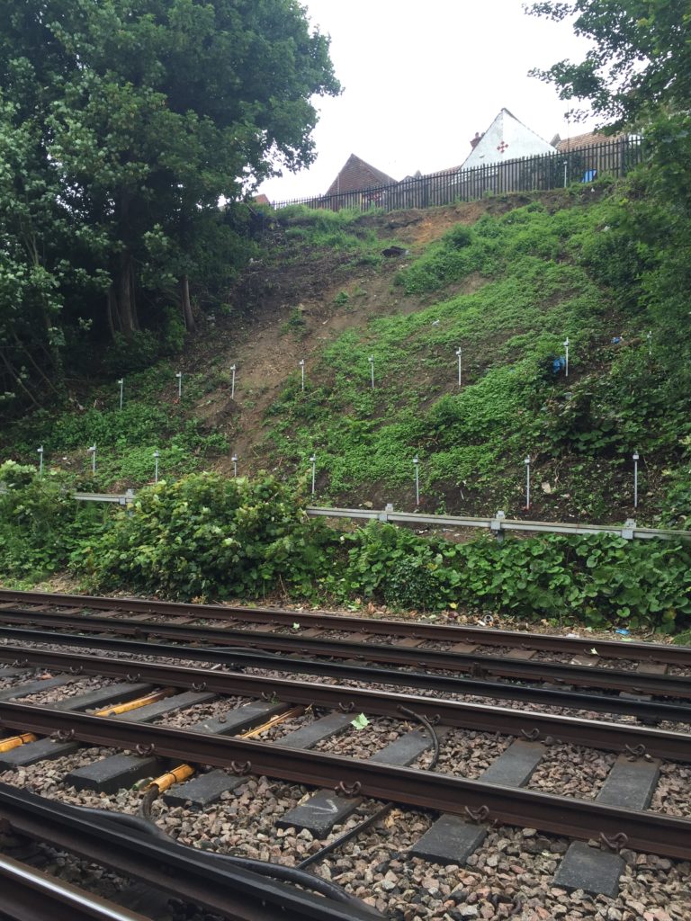
Network Rail feels the pressures of managing railway earthworks more than most national rail operators. Its network is intensively used and dependent on the performance of more than 190,000 earthwork assets in geologically diverse conditions. Most pre-date modern geotechnical standards by a century or more, and were built fast, cheap, and steep, in the Nineteenth-Century heyday of railway construction.
Asset management policy requires periodic examination of these cuttings and embankments − many of which are at remote locations. They are monitored and assessed to determine locations that might be vulnerable to landslides and require maintenance or repair.
As a result of the age, scope, and deterioration of the earthworks, combined with more extreme weather events, engineers face considerable challenges that are not readily solved by long-standing inspection and assessment methods. Record-breaking rainfall figures have coincided with a growing number of slope failures in recent years, and it is widely recognised that a better solution is needed to manage the risks associated with trains hitting debris on the track, or damage to the material supporting the track.
Wireless solution
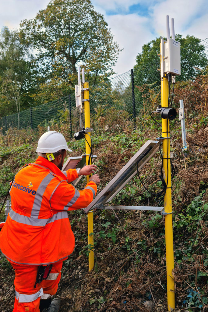
That better way takes the form of wireless condition monitoring technology that is simple to install and operate and provides automated warning of slope failure based on a huge volume of virtually real time information. The system is built around the Senceive FlatMesh™ wireless mesh communications platform. Movement is detected by a series of triaxial tiltmeter sensors that detect rotational movement and report to a solar-powered cellular communication gateway that relays data to the cloud and to Network Rail Control. 4G digital cameras that can operate day and night provide high resolution images on a pre-set schedule, or when triggered by an alert.
In many situations it compares favourably to more well-established ways of gathering information. The traditional, manual monitoring approach tends to involve periodic visual examinations or collecting geotechnical data from instruments such as inclinometers, piezometers, and extensometers. This requires an individual going to site, perhaps on a monthly basis, reading the instrument, taking those readings back to the office, downloading them, and interpreting them. It may provide an indication of long-term change at a site but doesn’t tell when a landslip has happened. In most cases the first news of such a failure comes when a train driver or member of the public reports it.
Engineers at Network Rail were convinced of the effectiveness of the wireless remote monitoring solution following the prevention of a potential disaster at Barnehurst in Kent in 2018. Here, an early installation of just 20 sensors and automated cameras detected a landslip and alerted controllers to close the line just before the morning rush hour kicked in.
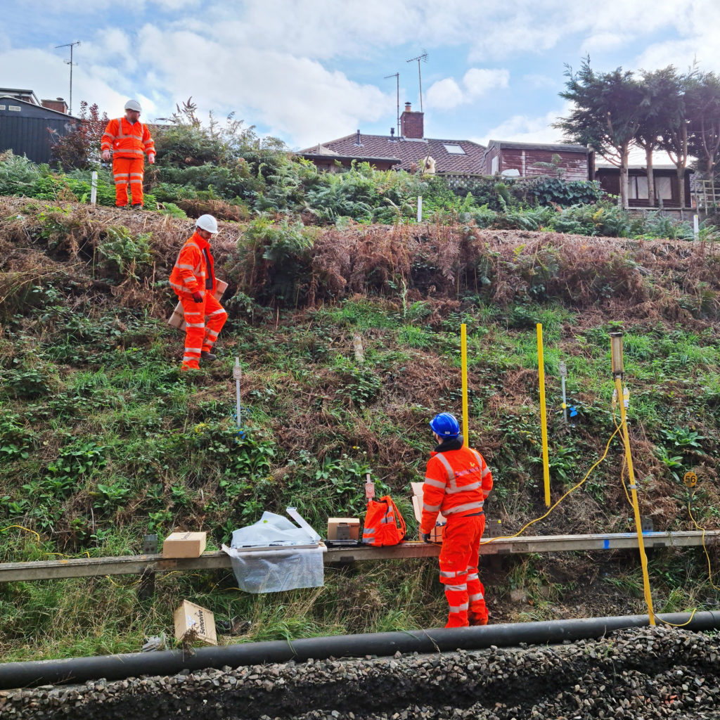
One of the advantages of this system is the speed and ease of deployment. Faced with the challenge of instrumenting 20km of track at 36 locations in a period of just four months, Senceive, Network Rail, and contractors BAM Nuttall and J Murphy installed 5,790 tiltmeters, 222 cameras and 111 gateways. The mesh communications network can incorporate a wide range of sensors, such as the piezometers at Pagdene Cutting that are reporting soil moisture data without the need for site visits. The system will operate with minimal maintenance for 10-15 years, at which point sensor batteries will need replacement.
Network intelligence
Once installed, the remote monitoring system is operational almost immediately and, while it is normally set to sample every 30 minutes to optimise battery life, it is smart enough to respond to events, for example by increasing sampling frequency to near-real time and sending high resolution imagery in the event of movement outside pre-set thresholds.
This is invaluable in preventing false alarms, such as those caused by a tree branch falling on a sensor. The frequency band used by the Flatmesh communication platform is higher than that used by most other wireless monitoring systems (2.4MHz vs. around 0.9MHz). This allows more sensors to be concentrated in a dense network and provides assimilation and transmission of data with minimal lag time. These are critical considerations when the possible consequences of delayed reporting are considered.
The system has already proved its value by warning of a landslip at the approach to Wadhurst Tunnel in East Sussex after heavy rainfall. Movement was detected and near-real time alerts were sent to asset managers and ‘flight engineers’ at Network Rail’s Control Centre, which manages train movements. The line was closed and the risk of an accident averted.
The impacts are far-reaching. In the areas covered so far, when the ground moves the trains can be stopped − almost immediately. This means improved network resilience in the face of a warming climate, improved safety through reduced risk of derailments, and fewer site visits, reduced carbon emissions, and another step on the journey towards intelligent infrastructure and predictive maintenance.
The Network Rail routes in Kent and Sussex are international pioneers in large-scale intelligent earthworks monitoring. Rollout is now underway in Wessex, with more deployments in Kent and Sussex ongoing. Work is already underway to extend the initiative across the UK and then overseas, with significant progress in France, Germany, the USA, and more.