

Chris Preston has experienced a diverse geospatial career in the rail industry and seen the rise and fall of many significant technologies. The former Professional Head of Topographic Services at Network Rail and most recent past-president of the Chartered Institute of Civil Engineering Surveyors reflects on changes in survey and monitoring methods, looking specifically at the impact of one of the technologies that is very much in the ascendancy – wireless remote condition monitoring.

Back in the Sixties and Seventies, monitoring was a labour-intensive affair, requiring regular site visits by staff. It usually provided relative rather than absolute measurements, often from simple taped offset measurements from a theodolite, or angles and distances to points for tunnels and retaining walls based on conventional optical levelling. Borehole monitoring was often limited to simply lowering a probe to see if the tube had sheared. Issues regarding accuracy and repeatability were common and there was little chance of early warning of instantaneous events such as a landslip or retaining wall failure. Results were derived from manual calculations, with a slow response to stakeholders.
In the Eighties and Nineties, monitoring was still labour-intensive, but the advent of absolute monitoring meant that all the measurements in an area could be based on a single coordinate framework. Computer analysis of the survey network improved accuracy and efficiency, but some relative measurements were still used. The classical surveying triangulation and distance network was replaced by GPS in the Nineties, bringing significant improvements in efficiency. Angles and distances to individual ground markers were used and digital levels with a bar-coded level staff improved the speed of measurement.
Although this provided greater accuracy, there were still repeatability issues and little chance of detecting the crucial early signs of a sudden failure. Wider use of computers enabled manual data input into spreadsheets and the response time to stakeholders began to improve.
More data, fewer wires
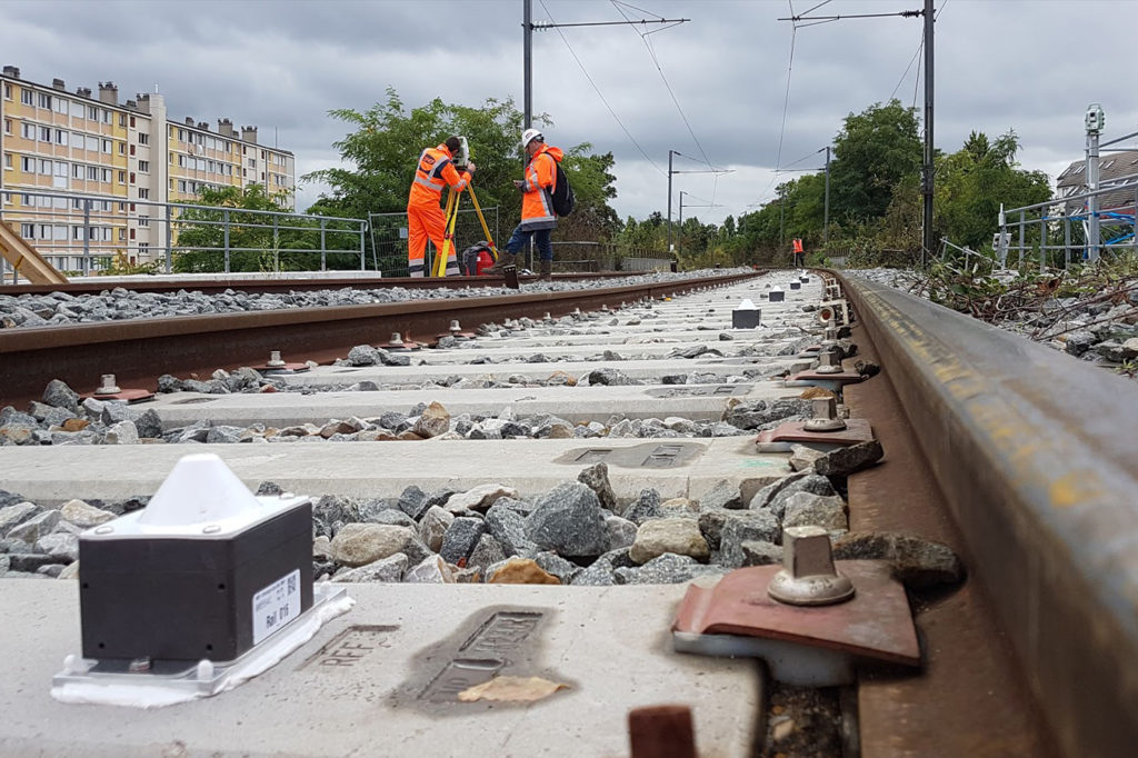
Since the turn of this century, monitoring has really benefited from the use of modern technology. Total stations have become automated and additions to the toolbox include laser scanners, GNSS, precise levels, extensometers, tilt sensors, inclinometers, tell tales, digital callipers and automated cameras. Weather stations provide environmental monitoring, and noise and vibration can be measured automatically.
Surveying total stations are now able to lock on to individual survey prisms (Automatic Target Recognition) in a defined observation sequence, as well as providing a camera view of the location being observed. This is helpful should a prism be damaged or obstructed.
But most of these systems still need power supplies and extensive cabling, and site visits to collect data from sensors. This is problematic in view of the drive to keep boots off the ballast.
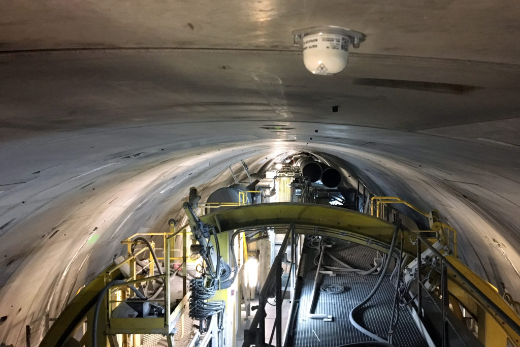
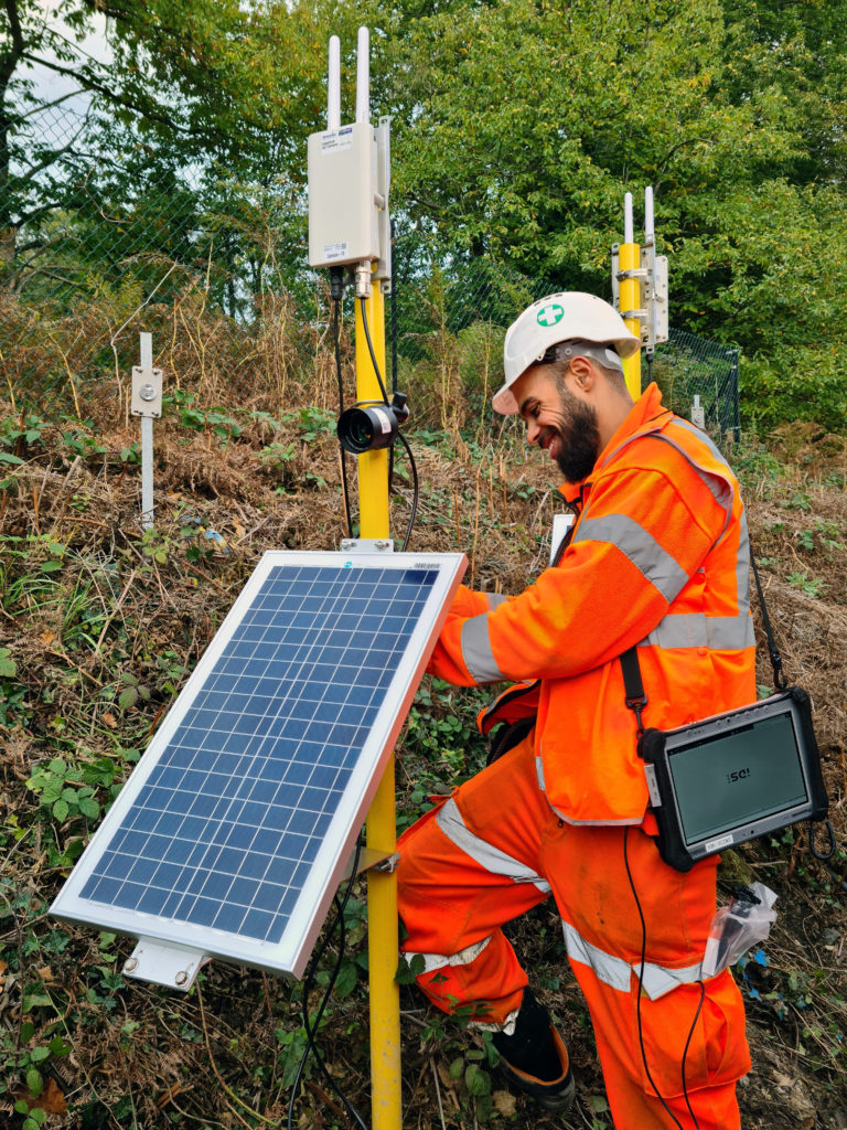
It is therefore no surprise that the rail sector has led the way in adopting wireless remote monitoring technologies to detect early signs of asset failure and track gradual changes in geometry. These autonomous systems comprise long-life sensors and wireless communications platforms, often powered by solar panels. They provide stakeholders with data in near real-time. Whilst the technology is robust and the measurements highly repeatable, it is often used alongside more orthodox survey instrumentation and manual inspection for validation.
Widespread implementation
Many of the high-profile infrastructure projects in the UK have relied on data from wireless remote monitoring and will continue to do so into the future. Examples include the East Coast Main Line capacity improvement project at Werrington and construction of the A14 viaduct over the same line. In both cases, wireless track sensors have informed project teams of movement and changes in geometry associated with the ongoing construction works below and above the railway.
HS2 has commissioned large-scale deployment of wireless remote condition monitoring, mostly on existing assets within the zone of influence of ongoing or planned construction activity – one example being the track and structures at Curzon Street in Birmingham.
At the southern end of the route, many hundreds of track sensor nodes are in place on the lines outside Euston Station, gathering baseline data on track geometry. They are set to remain throughout the construction phase. Comparable deployments are being commissioned at Old Oak Common.

Monitoring systems
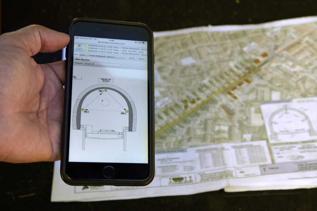
Wireless monitoring has certainly not replaced optical surveying and the two approaches are often used in tandem. An example was on the Luas light rail system in Dublin during nearby construction. Total stations known as ‘MultiStations’, a digital level, wireless tilt sensors and Leica GeoMoS monitoring software were combined to allow non-intrusive movement monitoring. These instruments scanned the dual tramway continuously and hosted live data directly onto a secure webpage for the relevant stakeholders to review. The captured scans consist of thousands of measurement points with x,y,z coordinates.
Three initial scans set a baseline; all subsequent scans were compared to this. The system provided automated alerts notifying designated stakeholders when values exceeded a designated threshold. To provide assurance, physical on-street precise levelling – captured by a digital level – was undertaken weekly.
Automation and Artificial Intelligence
As time passes, monitoring systems are becoming smarter and more automated, bringing many of the benefits associated with the internet of things. In contrast to the toolkit of earlier decades, they are not just dumb instruments and can do far more than just take measurements and send them to stakeholders: they can respond to events such as ground movement at one sensor location by triggering the wider sensor network to wake-up and send reports at high frequency – less than a minute – and to transmit images of the site in any light conditions.

In most railway environments, these result in automated alerts being sent to stakeholders. The most sophisticated and robust systems can send alerts directly to route control, triggering a decision-making process that will reduce train speed or even close the line in the event of a significant event such as a landslide blocking the line. In most cases, human intervention such as a site visit is still the first response. Validation and sense checking is a wise precaution to prevent false positives.
Case studies
The value of wireless monitoring was proven in the well documented case at Barnehurst in south-east London in 2019. A Senceive FlatMesh wireless monitoring system comprising tilt sensors and cellular cameras detected the early signs of a landslip and sent alerts of localised gradual movement over the course of two days, during which time trains were allowed to run at reduced speed. When the slope finally gave way and deposited some 300 tonnes of earth and vegetation on the track just a few hours before the morning rush hour, the system sent alerts and images in near-realtime and signals were immediately set to red. Whilst this did not prevent disruption, it significantly reduced the risk of a potentially dangerous derailment.
Following this compelling demonstration of how intelligent monitoring technology can dramatically reduce the dangers and disruption caused by slope failure, Network Rail has adopted the technology on a wider scale on a number of routes. In Kent and Sussex, nearly 6,000 tilt sensor nodes, 222 cameras and 111 wireless communication gateways have been installed to relay data from site to the cellular network.
One of the attractions of wireless monitoring solutions such as the Senceive FlatMesh solution is the speed and simplicity of installation. In the event of a structural or geotechnical failure, a system can be installed in hours, providing engineers with crucial insight regarding ongoing movement.
The value of this type of emergency monitoring was demonstrated on the West Coast Main Line near Rugby in January when heavy rainfall washed out material supporting the tracks. Data from an emergency monitoring kit helped engineers to keep trains running through the following week while repairs were carried out, therefore reducing the impact of the incident.
What next?
In many situations, wireless remote monitoring is most effective when integrated with other systems and data platforms to deliver a wider range of information and greater confidence in the outcomes. Taking the example of slopes, data acquisition systems could combine wireless tilt sensors and cameras with terrestrial or satellite synthetic aperture radar. Data management and automated decision-making process could integrate their data with highly localised weather forecasting.